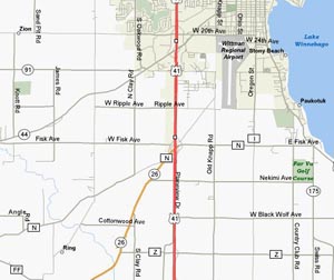
Below is an overview map showing Wittman Regional Airport, which includes the location of the arrival procedure entry point, Hwy 26 and County Rd Z near the Quarry approximately 5 miles Southwest of Oshkosh.
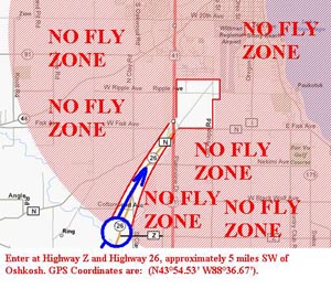
The following picture shows the Ultralight/Homebuilt Rotorcraft pattern entry to EAA AirVenture Oshkosh. Notice that the only approved entry is at Hwy 26 and County Rd Z near the Quarry, approximately 5 miles Southwest of Oshkosh. From there proceed at 300 feet AGL Northeast along the right (East side) of Hwy 26 to the Hwy 26 and Hwy 41 intersection.
Note: Departures from the pattern should fly Southwest along the right (West side) of Hwy 26.
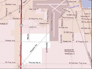
The map below shows a closer look at the overall Ultralight/Homebuilt Rotorcraft pattern. The overlaying red stripes signify the "No Fly Zone" again just to drive the point home. Zooming in closer at the pattern, notice that the Western boundary is Hwy 41 (never overfly Hwy 41 itself), the Southern boundary is County Rd N (always remain just North of County Rd N), those are the easy ones. Where most have trouble is with the Eastern and Northern boundaries. We'll continue with more pictures and close ups so you can familiarize yourself with the landmarks and procedures.
The next picture highlights the overall Ultralight/Homebuilt Rotorcraft flight pattern with a yellow line for the Ultralights, Light-Sport (LSA) and Rotorcraft, and orange line for Powered Parachutes and Paramotors. The landmarks are labeled here and in the upcoming photos as well. Note: New leg of pattern in SE Corner established in 2023.
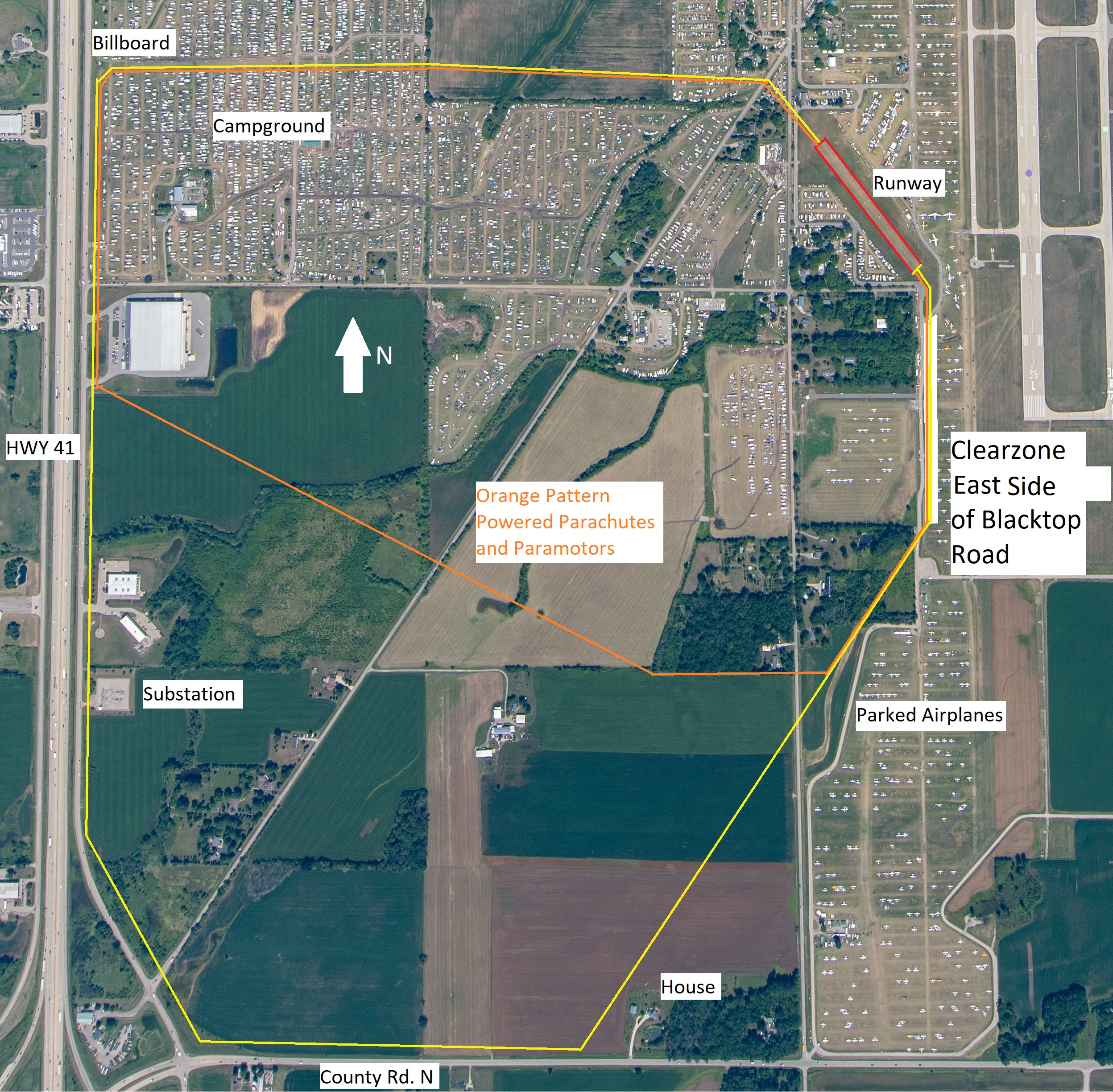
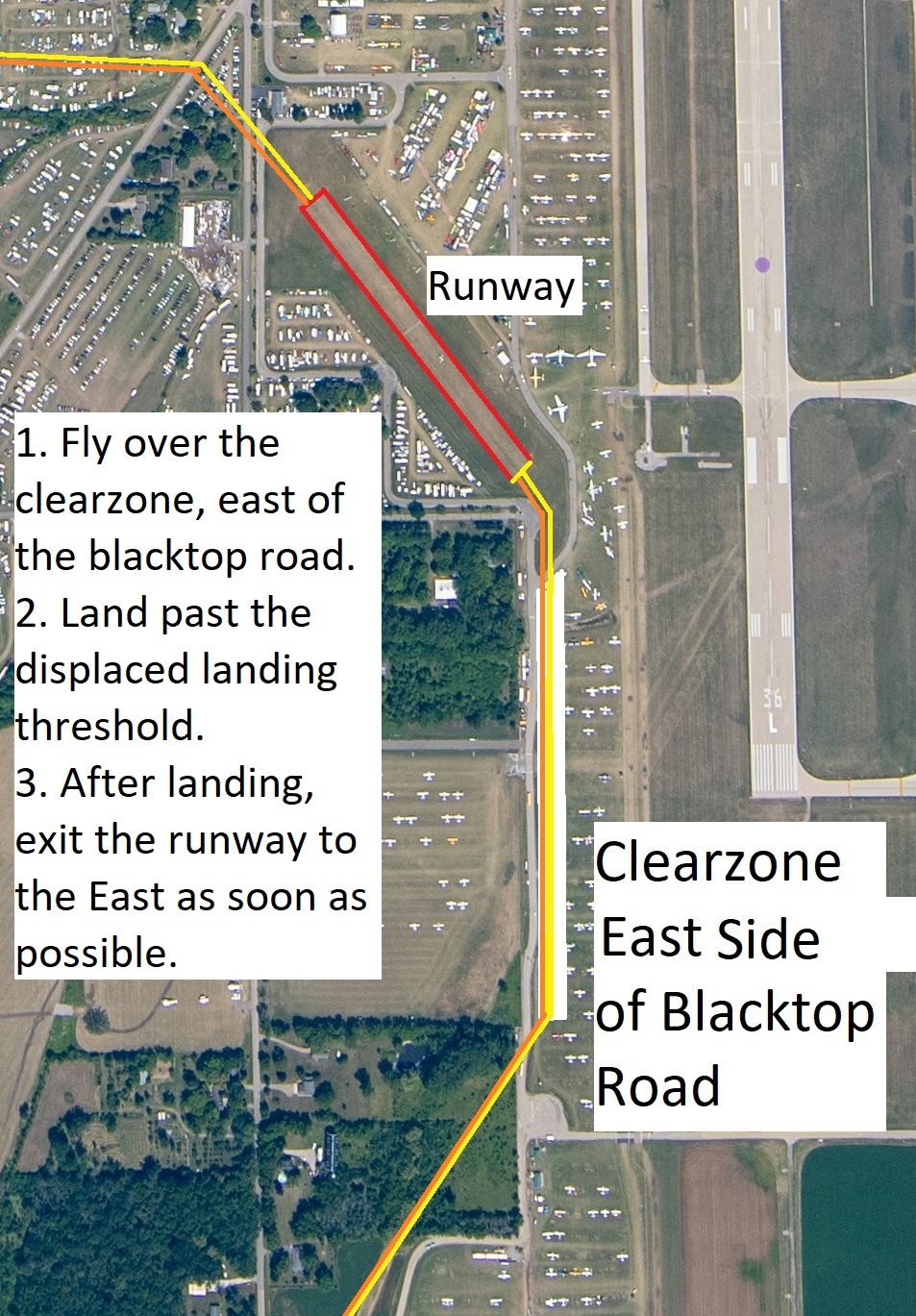
The image below indicates the major landmarks of the Eastern portion of the pattern as well as the actual runway. This portion of the pattern is where the potential for trouble is probably at its highest. It requires that pilots fly over the Clear Zone East of the paved blacktop road parallel to runway 18/36. Immediately East of the paved blacktop road is a Clear Zone to fly over, then East of the Clear Zone is aircraft parking for Vintage general aviation aircraft, and East beyond that is runway 18/36. You should fly DIRECTLY over the Clear Zone on your base leg and not swing wide to the East over the parked aircraft, or West over the paved road. Ultralight pattern altitude is 300ft AGL and you should begin your descent once on base over the Clear Zone.
Pay close attention to the runway displaced landing thresholds. Fly on the East side of the paved blacktop road, over the Clear Zone. DO NOT fly over the parked aircraft. Use caution for numerous obstructions including the light pole at the end of the runway.
NOTE: New for 2024 is a Clear Zone parallel to and on the East side of the North-South paved road. Fly over the top of the Clear Zone.
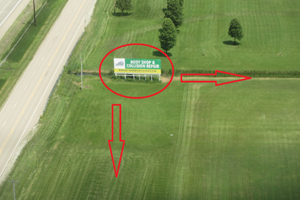
Moving to the Northwest corner of the pattern. The biggest problem here is when arrivals enter the pattern at Hwy 26 and Hwy 41, and need to proceed North parallel to Hwy 41 due to the current weather and winds dictating a Southern operation, when we are flying in a clockwise rotation. Those new arrivals are proceeding North along Hwy 41 looking for their turning point to proceed East. The turn point is the Clear Zone immediately South of the billboard. You should turn East overflying the Clear Zone before the billboard to remain over the Clear Zone. You should never overfly the campers or campground. The billboard is shown below. You should never be North of this billboard.
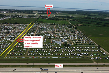
The below picture is looking East showing the Clear Zone marked with cones through the campground just Southeast of the billboard. Overfly this Clear Zone. Never overfly the campers.
NOTE: If there is an incident or accident on the runway the FAA requires the runway be closed. When the runway is closed, aircraft are not allowed to land or takeoff. If the runway is closed a large yellow colored X will be placed on the runway threshold indicating the runway is closed. Make appropriate plans to divert to an alternate airport if the runway is closed. If radio equipped tune to Ultralight/Homebuilt Rotorcraft advisory frequency 123.75 and listen for any runway status updates.
